By Karl Blankenship
Bay Journal
Underwater grasses, one of the most closely watched indicators of Chesapeake Bay health, surged to the highest levels seen in decades, according to survey results for 2016.
This is the second straight year that grasses have set a record.
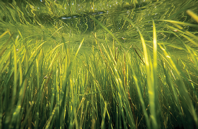
Nearly 100,000 acres of the Bay’s and its tidal tributaries were covered by the underwater meadows, which provide habitat for juvenile fish and blue crabs, as well as food for waterfowl.
That was an 8% increase over 2015, and more than twice what was in the Bay just four years ago.
“It was an impressive year following a previously impressive year and we are at numbers that we’ve not seen — ever,” said Bob Orth, an underwater grass expert with the Virginia Institute of Marine Science who oversees the annual aerial survey, which began 33 years ago.
Like all green plants, submerged grasses need sunlight to survive, and the clearer the water, the more sun they get. Because of the link to water clarity, the annual survey of Bay grasses — often referred to by scientists as SAV, for submerged aquatic vegetation — is considered a key indicator of how the Bay is doing.
Critical to Bay ecosystem
In their own right, grass beds are also a critical component of the Bay ecosystem. In addition to providing food for waterfowl and shelter for fish and crabs, they also pump oxygen into the water and trap sediments.
Restoring underwater grass beds is one of the goals of the nutrient and sediment reductions aimed at cleaning up the Bay, as water clouded by sediment or nutrient-fueled algae blooms can be lethal to grass beds.
The Bay’s underwater grasses were knocked back to 48,195 acres by the one-two punch of Hurricane Irene and Tropical Storm Lee in late summer 2011, which sent a flood of nutrients and sediment into the Chesapeake.
But relatively dry conditions since then, which reduced the flow of nutrients and sediments into the Bay, have helped the grasses recover. The result has been unusually clear water in many areas. In fact, some grass beds are becoming so large and robust that they may be able to withstand at least some severe weather events, scientists said.
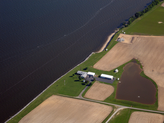
Water has been so clear in places like the Upper Bay’s Susquehanna Flats, that scientists reported dense grass beds extending into deeper areas where they had disappeared in the wake of Tropical Storm Lee.
Clear water
Brooke Landry, a biologist with the Maryland Department of Natural Resources and chair of the Bay Program’s SAV work group, said that when she visited the flats on a field trip to train citizen scientists last summer, the beds were not only expanding but included an “incredible diversity” of species — at least 11.
“It was beautiful,” she said of the bed, which reached 5,993 acres last year. “We definitely saw grasses deeper than I would have expected, and the water was crystal clear.”
Overall, the survey mapped 97,433 acres in 2016. That was an 8% increase over the 92,315 acres observed the previous year.
But in 2016, the aerial survey was not able to map some areas due to a mix of weather and security restrictions near the District of Columbia and the Patuxent Naval Air Station. Specifically, parts of the Potomac and St. Mary’s rivers, including Piscataway Creek, were not surveyed in 2016 although they had been mapped the year before.
If those areas had the same amount of grass beds as in 2015, last year’s acreage would have increased by nearly 2,000 acres for a baywide total of about 99,400, said David Wilcox, a VIMS analyst who works on the survey. But even that number is conservative, Wilcox said, because grass beds near the unmapped areas also appeared to have expanded last year.
Last year’s mapped acreage represented 53% of the baywide goal of 185,000 acres, and it exceeded an interim target of 90,000 acres set for 2017 under the 2014 Chesapeake Bay Watershed Agreement.
One caveat is that much of the recovery is in the moderate-salinity areas of the Mid Bay, a region dominated by widgeon grass, which is a notorious “boom and bust” species that can disappear as rapidly as it pops up. More than half of all underwater grasses in the Bay are found in that area, and it accounted for most of last year’s increase as well.
“In 2003, we lost about half of the widgeon grass,” Wilcox cautioned. “If that were to happen next year, our story would be very different, because there’s so much widgeon grass out there.”
But scientists said they were encouraged that, at least in some places, they were starting to see other underwater species mix with the widgeon grass, which may help make the beds more durable over time.
“We’re starting to observe additional species in beds that were just widgeon grass, like redhead grass and sago pondweed, which is a great sign,” Landry said. “So if widgeon grass does crash, in some areas at least, these other species will continue to provide those ecosystem services Bay grasses are so important for.”
Differing salinity
Though grasses improved baywide, the survey found that trends varied in different salinity zones around the Bay.
The moderately salty waters — the largest area of underwater grass habitat, stretching from near Baltimore south to the Rappahannock River and Tangier Island and including large sections of most tidal rivers — had an increase of 20%, covering 57,380 acres.
Except for 1988, the survey has been conducted annually in the Bay since 1984, when just 38,229 acres were observed — the lowest ever seen. The Bay’s 185,000-acre goal is based on actual acreages that could be observed in historical photographs of the Bay, taken for other purposes during the early and mid-1990s.
Karl Blankenship, kblankenship@bayjournal.com, has been editor of the Bay Journal since its inception in 1991.


Recent Comments